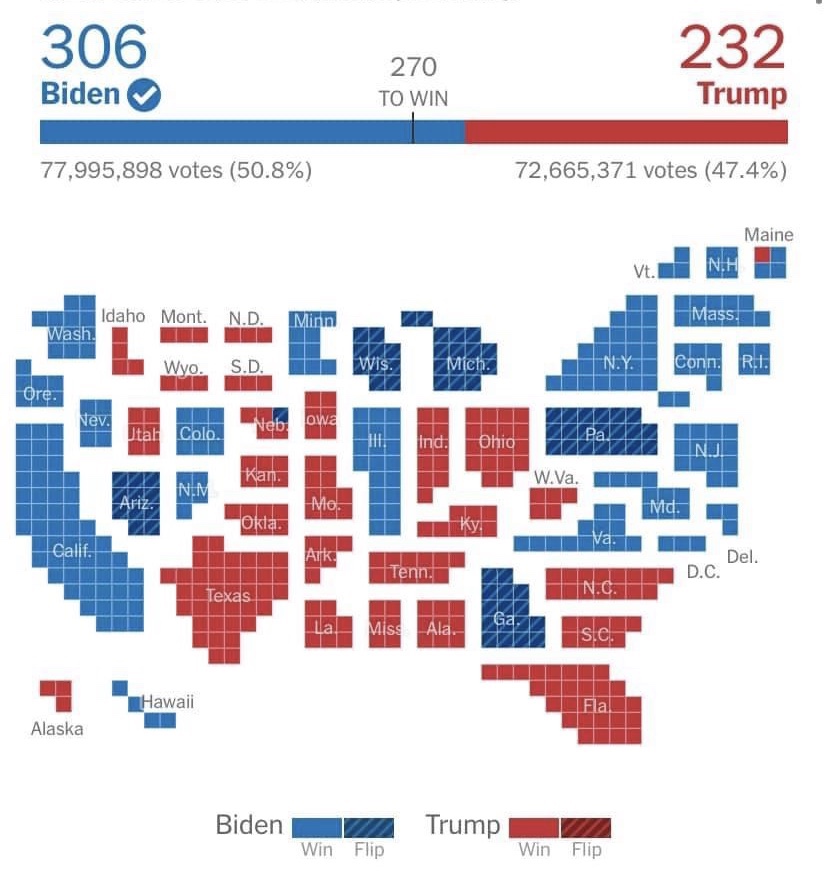
On the traditional election map, all of that red you see in middle of the country belongs to states that take up a lot land but have very low populations, and therefore single digit votes in the Electoral College.
This map of the 2020 election resizes the states to reflect their number of electoral votes.
